These are, without a doubt, the biggest and most important questions I needed to ask myself, for they help shape everything about the tour.
Did I want to do as many miles as possible each day thereby covering as many miles as I could in the time available, thereby making the ride itself the most important part of the tour, or did I want to do take it easier and take in what the country had to offer along the way? My personal preference was to do the latter – for me, being a keen photographer as well, meant that I did want to stop and find out about the places I was riding through. How could I possibly just pass by places I would never see again without knowing about them?
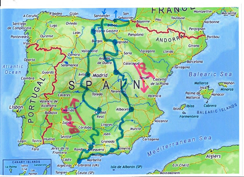
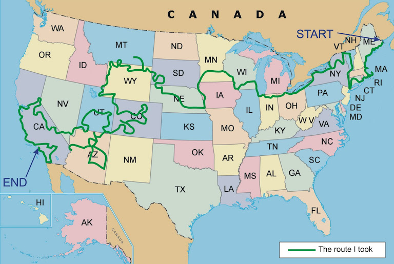
It was time to consult a map. I had a 1:3450000 scale single sheet big map that covered the whole of the USA and this was good for looking at what was where. New York – top right. California – bottom left. Great Lakes at the top. Rockies down the left a state or two inland. I found Yellowstone and decided that must be on my route. I saw Milwaukee and thought I should go there to see the Harley-Davidson factory and museum. I saw the Florida Keys and thought that must be included on my tour. It went on like this for a few days with me looking at some of the places on the big map and working out what I might want to see and where I might want to go.
Hang on! This was useless, for I was like a kid in a sweet shop – eyes darting everywhere, not deciding anything. This was not the way to plan a long tour. I needed to be more methodical.
The problem I had was that I simply didn’t know the USA well enough to plan such a tour. I knew a few cities and a few places that I might like to go to, but I just didn’t know enough and the big scale map I had only showed the main roads. It certainly showed all of the Interstate Roads but like most bikers, I don’t like riding on roads like motorways as they are mainly characterless and boring eyesores that are only any good if you are in a hurry.
I decided to buy two things – a pin board to put the map on and a couple of books about touring in the States. The first was easy – a quick trip into Stevenage to one of those stationary superstores and an hour later my big map was firmly attached to a big pin board.
Finding any good books about touring in the USA was not so easy. Sure I found a few on the Internet about touring the States in a car, but touring on a motorbike is a different thing altogether. A couple of the books I purchased have hardly been used at all since I received them. These are the type that concentrate upon listing great places to see, but hardly discuss possible routes, road types, scenery, twisty roads and all the other things I was interested in. I could only find a couple of books that seemed to be useful.
The first is “The Most Scenic Drives In America” which is a large Readers Digest book of 400 pages.
 It gives maps and descriptions of 120 road trips of varying length and it is not only incredibly useful, but it is well laid out and gives as much information about the route itself as it does the places along each route. The book is divided into 4 sections; the Western States; The Rocky Mountain States; The Central States; The Eastern States. Each section has between 24 and 41 routes and each route begins with a simple map showing which roads the route takes and numbered highlights to see along that route. Each trip is described on about 4 to 6 pages.
 The second book was the Guide
 to Scenic Highways and Byways (the 275 best drives in the U.S.) which is a National Geographic book. At 463 pages it is thicker than the other book and crammed full of the same sort of information - routes, small maps, what to see along each route etc. Although it has more pages, the size of this second book is smaller and could be taken with you on a motorcycle trip. The amount of information it contains is huge and I have no doubt it would be very useful during such a trip.
These two books were the catalyst for deciding where I might go on my own tour. With a pink highlighter pen I drew on my big map all 120 of the routes the Most Scenic Drives book. I put different colour pins in the map to indicate the places that I definitely wanted to go to. Next I used a very high-tech method to begin to plan my intended route – a ball of string! Like many things in life, simplicity is the key and I simply used the string and pins to join together those pink routes that I wanted to go on and very soon I had developed an outline overall plan of my tour. At that time, it meant I would ride in every one of the 48 contiguous (all except Alaska and Hawaii) States and this felt just right – seeing the whole of America – fantastic!
This overall plan took quite a long time to develop, about the first 4 months of 2008 in all. I started to list out the roads I would take and the places I would visit. It wasn’t until I took the string off the pin board and measured it against the scale of the map that I realised I had a problem, indeed an enormous problem. The total mileage of the tour was about 30,000 miles which at 150 miles per day would mean 200 days, or over 6 months!
For my circumstances, that would be wholly unrealistic. I knew that I was soon to retire, but 6 months away from home and my wife was never going to work. Time to think again!


.jpg)


No comments:
Post a Comment