
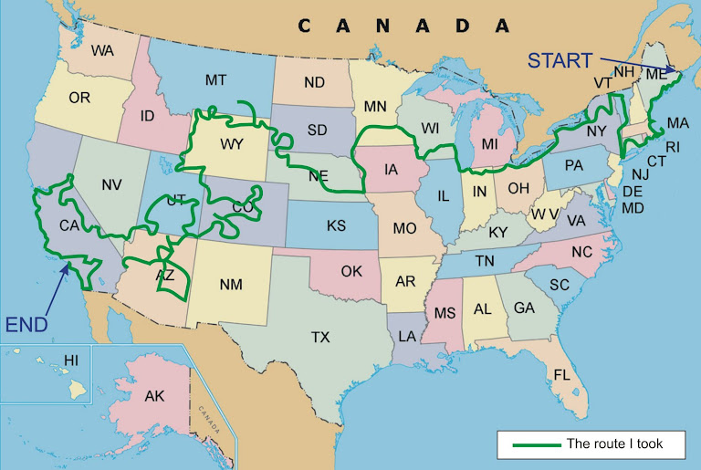
I did consider whether doing detailed planning was appropriate for my tour. Of course, I could have taken a chance just gone from place to place using my gut feeling without any detailed planning and I must admit, there was an appeal to that. The freedom that this type of touring would give could be very exciting. Not knowing what you would be doing or where you would be going from one day to the next could undoubtedly have its benefits. However, the thought of having missed something really good very close to where you have been because you didn’t know it was there would (to me) be very frustrating. This being a once in a lifetime tour, I would want to make the most of everything I could. So, for me, detailed planning was a must.
 To do this detailed planning, I took the overall route I had worked out and then looked at each State in turn that I would be travelling through. For each State I had purchased a road map of that state which showed all of the main roads, cities, towns, and key features of the state. The maps I purchased are by Rand McNally and they cost about £6 each. These are folded maps which are all 9 inches x 4 inches, or roughly 230mm x 100mm when folded. The scales vary depending on the actual size of the state. The ones I have vary from 7 miles to the inch to 21 miles to the inch.
To help you find these maps, if you enter the following ISBN number in Amazons website, you will find the map for New Hampshire and Vermont. This will lead you to the full range of Rand McNally maps. ISBN 978-0528856068
There is one really important point about these maps. Some of the roads have green dots shown alongside them. See below.

These green dots signify what Rand McNally consider to be scenic roads. I found that very often when doing the detailed route planning that I had a choice of many roads that I could take from city to city, or across a particular state. Given such a choice, I always selected a road with these green dots, as they will gives the best views, run alongside rivers, through valleys, over mountains or similar – all very tempting when on a motorbike!
So, all I did was to look at which roads I wanted to travel on and marked these in pencil on the maps. I did every State like this, forming one continuous route that matched (as near as I could) the overall rough plan on my big map.
This didn’t take too long, but it became obvious to me that having the route marked on the maps was all well and good, but practically speaking, having to constantly refer to a map when on the bike was not going to be a very good solution. I also needed to write down what roads I would use, mileages and the like. That would be the next stage of the detailed planning, State by State. But, that would have to wait as the tour of California was coming up!


.jpg)


No comments:
Post a Comment