
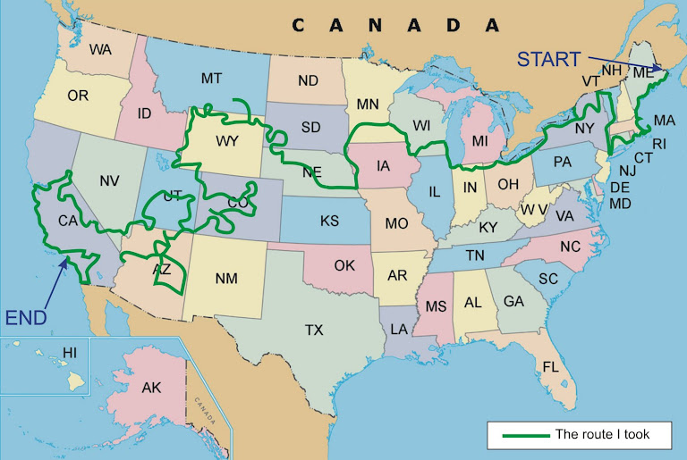
I had decided back in April that I would need to do some detailed route planning to determine which roads I would use to go through each State, rather than just deciding n the route as I went along. I had bought maps of each State and I had started to mark on those maps in pencil which roads I would take. To help do this, I used the two books “The Most Scenic Drives In America” and the “Guide to Scenic Highways and Byways” which gave me some very good information about what I might see on the way.
As well as the detailed State maps marked in pencil with my intended route, I needed to also be able to record what the road names / numbers are that I would be using, how many miles there are between towns or places I would visit, what places of interest I would expect to see along the route and how many days each part of the tour was likely to take.
Due to my love of lists, I created a spreadsheet that I would use to store all of this information. In the end, this turned out to be 20 pages of details that I would need on the tour. To me, this was essential as there was no way I could ever hope to remember all of the detail I was going to need. For me personally, a spreadsheet was just what I needed. For others, a simple list might be adequate.
If you want a copy of this spreadsheet, send an e-mail to me asking for it and I will send it as soon as possible.


Why Education Is Needed
16 hours ago


.jpg)


No comments:
Post a Comment